Shipai Fm
Type Locality and Naming
The type section is the Shipai-Tianheban section, lying on the south bank of the Yangtze River, about 16 km northwest of the seat of Yichang City (111°08’41” E, 30°47’01” N). The section was remeasured by Zhang (1978). In the type section, the formation is 162.92 m thick. The Shipai Formation was named by Li and Zhao (1924). The name is derived from Shipai Village, Sandouping Township, Yiling District, Yichang City, western Hubei Province. Li and Zhao (1924) originally called the formation Shipai Shale. Subsequently it was renamed Shipai Formation by Lu (1962).
Synonym:
Lithology and Thickness
The Shipai Formation is mainly a clastic sequence, consisting of greyish green and yellowish green hydromica-bearing clay shale, sandy shale and siltstone with several interbeds of thin-bedded purplish red, pink, and black oolitic limestone and bioclastic limestone. The formation is stable in lithology in the eastern limb of Huangling anticline, where the type section of the formation is located, while it increases calcareous content in the western limb of the anticline, resulting facies change in its middle and upper parts into argillaceous striped limestone intercalated with siltstone there. The rocks of formation are characterized by horizontal bedding and by development of horizontal burrow (foralite) and ripple marks, belonging to open shallow-water platform facies.
Relationships and Distribution
Lower contact
The Shipai Fm is in conformable contact with the underlying Niutitang Fm in western Hubei Province. In north-central Hubei Province. In north-central Hubei Province, it is in conformable contact with underlying Liujiapo Fm. The lower boundary is drawn at the disappearance of either the underlying black shale of the Niutitang Fm, or the limestone of the Liujiapo Fm.
Upper contact
The Shipai Fm is in conformable contact with the overlying Tianheban Fm in western Hubei Province. In north-central Hubei province. In north-central Hubei Province, it is in disconformable contact with overlying Shihlungtong Fm. The upper boundary is defined by either the appearance of thin-bedded argillaceous limestone at the base of the Tianheban Fm or thick-bedded dolomite at the base of the Shihlungtong Fm.
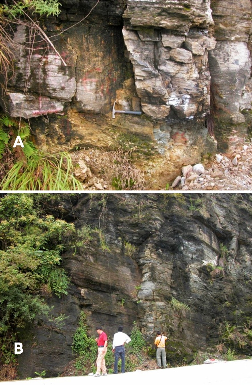
[Figure: Outcrop of the Shipai Formation (B) and conformable contact relationship between the Shipai Fm and the overlying Tianheban Fm (A). They are photographed on the side of Yichang-Liantuo highway, near Shipai Village in the Yangtze Gorge area, Yiling District, Yichang, western Hubei Province.]
Regional extent
The Shipai Formation is exposed the Yangtze Area of the South China Region, distributed in western, central and southeastern Hubei Province. The thickness of the formation decreases northeastward, varying from 294 m at Muxi, Changyang County in the south, to 49.88 m at Taijiya of Zhongxiang County, to merely 5 m at Zhujiayu of Nanzhang County, and pinching out completely in the area of Dahongshan Mountain in the north.
GeoJSON
Fossils
The Shipai Formation is well fossiliferous, dominated by trilobite Redlichia. In the Yangtze Gorge area, the formation yields trilobites Redlichia kobayashi,R. meitanensis, Ichangia conica, Kootenia yichangensis, Neocobboldia hubeiensis and Palaeolenus lantenoisi, etc. and brachiopods. In the Dahongshan Mountain area (Zhongxiang and Jingshan counties) central Hubei Province, the formation yields Redlichia guizhouensis, Pachyaspis (Danzhaina) jingshanensis, and Mufushania ezhongensis. The faunal assemblage in central Hubei is slightly younger age than that in western, indicating the formation is more or less diachronous.
Age
Depositional setting
The formation belongs to open shallow-water platform facies.
Additional Information
